This is the Gordon Snarr Farm located between Hwy 75 and the Red River about 3 miles north of the town of Morris, MB.
Our friend Dale flew over in his little yellow bumble bee yesterday and took some great aerial shots of the farmyard and flood! Thanks so much Dale! Enjoy a couple of them below!
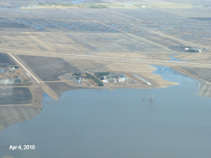
April 4, 2010 - Looking West from the Red River (below the bottom of the pic) past the farmyard and Hwy 75 at the top and beyond! Yes we have lake front property again! Also a bit of Allen and John Snarr's farmyard is on the left hand side and Brian Klassen's is across Hwy 75 from us.
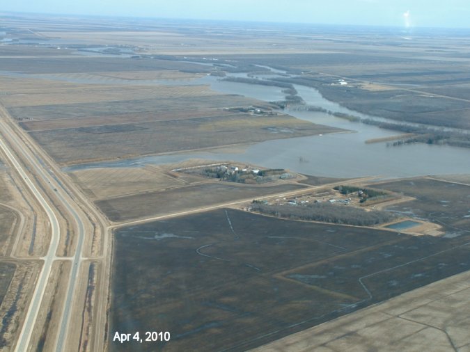
April 4, 2010 - Looking NE. Allen's yard is at the bottom then ours and you can see the Red River snaking past on the right hand side.
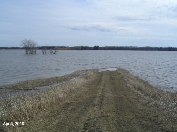
April 4, 2010 -Looking straight E from the back of the dike. The field road below the farmyard is now completely under water. Logs have begun to float in and collect along the dike. Water is slowing down and has only risen about 2 inches each day for the past couple of days.
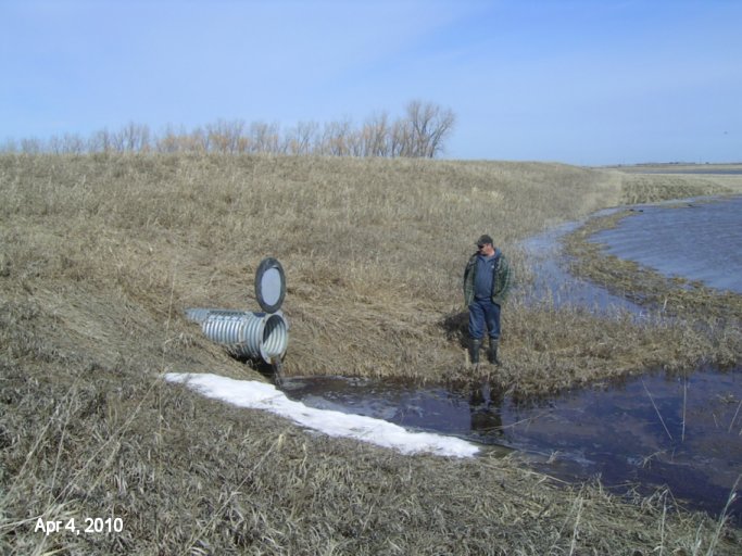
April 4, 2010 - Looking back at the dike and our one 24 inch culvert. The level of the bottom of the culvert (inside the ring flange) is the same level as the top of the bridge deck of the Morris River Bridge on Hwy 75. We still have a foot and a few inches of clearance before we need to close the culvert. With it slowing down, perhaps we won't have to! This also means that perhaps Hwy 75 will not close either! Water is definitely on the our dike now though!
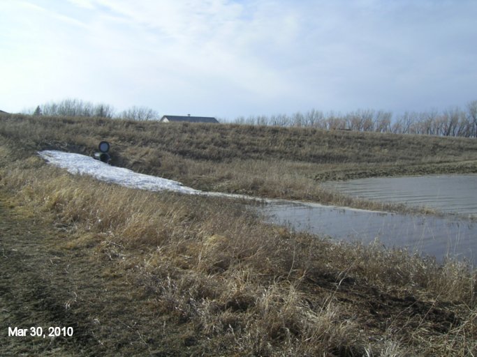
March 30, 2010 - Drove to town this morning and noticed there is now about 3 feet of free board on the Morris River bridge on Hwy 75. If the Hwy doesn't close this flood, it will be close!
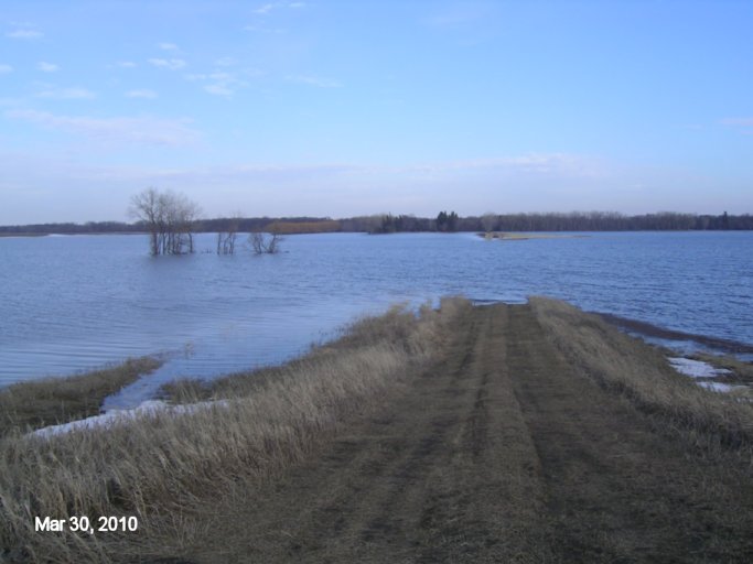
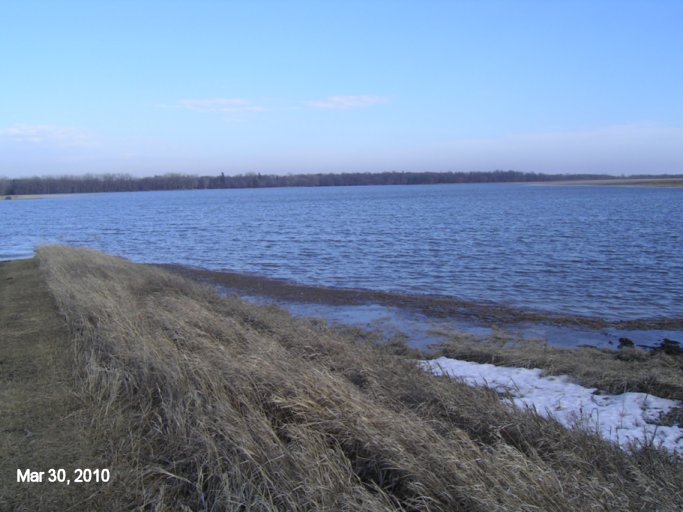
March 30, 2010 -Looking straight E from the back of the dike. All the ice is now gone again and indeed the water is still rising.
March 30, 2010 - Looking SE from the back of the dike. Snarr Rd (formerly known as Rd 27N) is now under water at the bottom towards the Red River. You can also see the row of flood debris, mostly straw, starting to collect as the wind blows it.
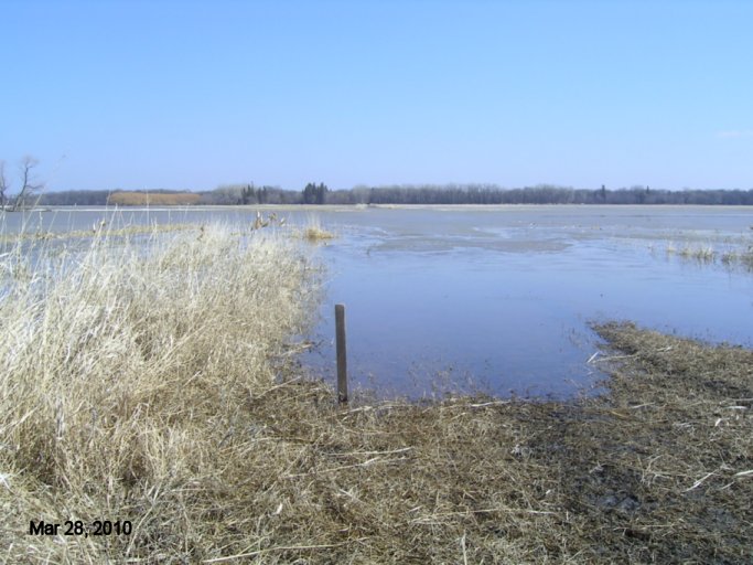
March 308, 2010 - Looking from our flood stick on the road towards the back of our dike. The water is inching towards the end of the field and at this rate will be touching our dike in a day or two.
March 28, 2010 - Flood stick down behind the dike E of the yard on the field road. Haven't seen much of any great water level changes in the past 2 days. It goes up a little and down a little. Maybe this is it? Time will tell!
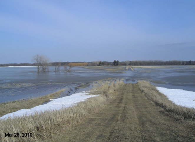
March 26, 2010 - Looking straight E from the back of the dike. The freezing overnight temps have really slowed things down here but soon it will all be flowing again by the weather forcasts. On my way home from work today, I noticed MB Hwy's has placed portable LED signs again at the perimeter and coming out of St. Norbert. They're just getting ready in case they need to close Hwy 75. Looked at the Morris River bridge last night and it's still had 5-6 feet of freeboard. Time will tell if they need to close the Hwy 75 or not. We may know as soon as Monday I bet.
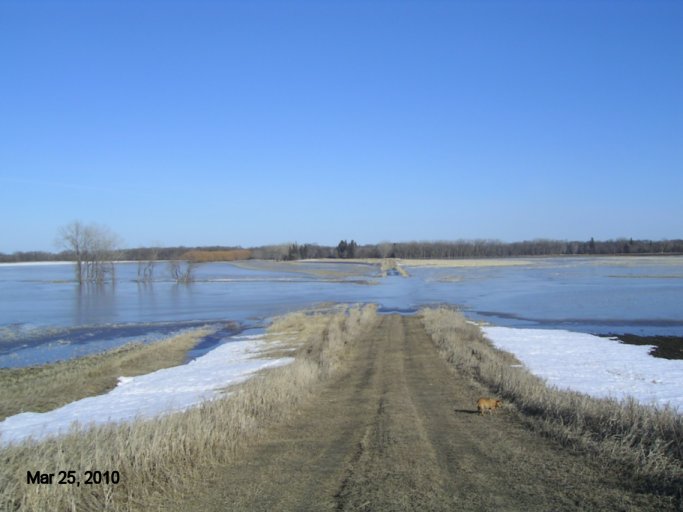
March 25, 2010 - Looking straight E from the back of the dike.The frozen flood over night has slowed things down a bit but not much! Now all the stubble left over from last year is frozen in and as the flood floats the ice, it will pull the stubble out with it. This is one way that straw is added to the flood water and ends up plugging culverts and gathering in flooded corners in the wind.
Click here for older pics.
Last updated April 05/10